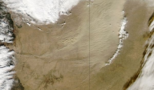

The NASA Image of the Day shows this massive dust storm moving across Colorado and Kansas. The extreme drought of the past two years has dried out the soil, reduced vegetation cover, and produced multiple dust storms in the past few months.
The storm started in Colorado from several places. One source was about forty miles south of Colorado Springs. The image above shows the storm moving from west (left) to east. The thin line of white clouds on the right is the front of the dust storm. The black lines are state boundaries.
 By the time the dust storm reached Kansas, it stretched 150 miles across the front and reduced visibility to a quarter mile.
The image from the drought monitor (right) shows the middle of the U.S. and Mexico. The dark red is extreme drought.
Top image from NASA Earth Observatory; right image from Drought Monitor
You must be logged in to post a comment.