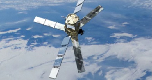
If you see a three pointed star moving along the sky next time you look up, it may be measuring the moisture content of the soil you’re standing on. In early November the European Space Agency (ESA) launched a Soil Moisture and Ocean Salinity (SMOS) satellite to monitor water conditions from space. The mission of SMOS is to monitor and deepen our understanding of Earth’s water cycle.

The SMOS utilizes a Microwave Imaging Radiometer with Aperture Synthesis (MIRAS)- the new technology borrows principles from radio astronomy, allowing this relatively small (8 meters wide) satellite to do the monitoring work that typically requires a large antenna too big for space. The satellite’s LICEF antenna-receivers measures radiation emitted from the Earth and uses that information to track data on soil moisture and ocean salinity.
The information will assist climate scientists in predicting droughts, floods and other water extreme weather phenomena, allowing predictions to be faster and more accurate, even fill in knowledge and understanding gaps that surface observation cannot provide.
“Climate change is a fact, but its impact on precipitation, evaporation, surface runoff and flood risks is still uncertain. The availability of water plays a more important role on these impacts than temperature itself,” said Yann Kerr, SMOS mission scientific director.
In addition to helping scientists measure soil moisture to a 2 meter depth, the SMOS satellite will also help measure CO2 concentrations around the globe. Even more, it will measure the salinity levels of ocean surface water, giving scientists a better understanding of oceanic circulation patterns.
The quest for understanding and adapting to climate change has gone space age.
You must be logged in to post a comment.